

With the end of the Seven Years’ War, Great Britain found itself in possession of vast new territories. The government looked on these holdings as a means to reduce the enormous debt built up during the war but, when it came to utilizing those resources, existing “salutary neglect” policies and practices simply did not suffice. Before developing new systems, officials needed information and they first turned to existing maps. A significant contribution to these plots came from an officer named Samuel Johannes Holland.
Born in 1729 in the town of Deventer in the Netherlands, Holland joined the Dutch artillery in 1745 and received training in engineering and fortifications during the War of the Austrian Succession. An intelligent cadet officer with a mind for engineering and cartography, he assisted in surveying and drawing maps and soon began creating his own.[1]
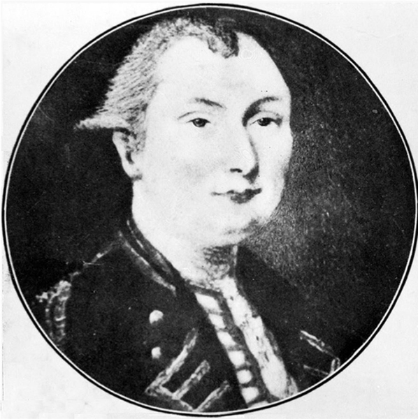
In 1753, now Lieutenant Holland came to the attention of the Duke of Richmond as he toured battlefields with his tutor Guy Carleton, a future governor of Canada. A friendship soon developed between Holland and the duke. In 1756, Richmond convinced Holland to join the newly-formed British 60th Regiment of Foot, better known as the Royal American Regiment.
Holland did not serve as a typical company officer. Upon Richmond’s recommendation, Lord Loudoun, the regiment’s colonel and North American commander-in-chief, appointed Holland as an acting engineer and draftsman. Ordered to prepare a map of the Hudson River-Lake Champlain corridor, Holland utilized previous surveys and other sources as the basis for the map. Quite satisfied, Loudon promoted Holland to a captain-lieutenancy.[2]

Not content to rely on unfamiliar sources of information, Holland scouted enemy positions around Ticonderoga in 1758 and sketched a map of the environs.[3] He missed the disaster at that place in July by being transferred to Gen. James Wolfe’s command for the campaign against Nova Scotia.
Wolfe admired Holland’s work during the siege of Louisbourg: “Hollandt the Dutch engineer has been with me the whole siege, & a brave active fellow he is, as ever I met with; . . . I hope my Lord George [Germain] will take him into the Corps of Engineers, & when there is any business to be done, he will find him the most useful Man in it.”[4]
After the taking of Louisbourg, Holland created a detailed map depicting the fortifications and progress of the siege.[5] During this endeavor, he taught surveying and mapping to the sailing-master of HMS Pembroke. A decade later, in 1768, when England decided to explore the Pacific Ocean, the Admiralty had but one choice of a commanding officer who also had surveying and cartographic experience, Holland’s student, James Cook.
After surveying the St. John River and overseeing the building of Fort Frederick, the future site of St. John, New Brunswick, Holland joined the Quebec City campaign in 1759. As the fleet moved up the St. Lawrence River, teams leading the way (including Holland and Cook) took depth soundings and landmark sighting measurements. Accurate sailing instructions then went to the ships following. In 1760, Thomas Jefferys took those readings and published a map that would remain in use for decades.[6]

During the siege, Holland saw to the building of works surrounding Quebec. Accompanying Wolfe on an exploration of the riverbanks, the two noticed people on a beach beneath the cliffs who disappeared into the trees only to reappear on the Plains of Abraham at the top. Clearly, there had to be a passage up the cliff and Wolfe decided to make use of it to facilitate an attack on the city.
Holland (now a captain) had command of a gunboat during the battle. When a ship ran over his craft, he swam ashore, climbed the trail, and received a wound during the battle. A favorite of Wolfe (the general had presented Holland with a brace of pistols), the story goes that Holland stood at Wolfe’s side when the general died from his wounds.[7]
With the ending of hostilities in Canada, Holland’s focus returned to map-making. General Amherst ordered Quebec governor James Murray to create a map of the St. Lawrence from Montreal to Quebec City. In addition, surveying teams would gather demographic information on the settlers living along the river’s flanks.[8]
Holland discovered that Engineer Lt. John Montresor had erased his name from one of the resulting maps. In the following commotion, Holland’s already notable reputation gained a boost. In a letter to the Board of Trade, Murray echoed Wolfe, calling Holland “an industrious brave Officer, and an intelligent Engineer, in which capacity he would be desirous, and deservedly merits to be advanced.”[9]

While in Quebec, Holland’s personal life took a change of course when he met Marie-Josephte Rolet. They would remain together for the rest of their lives and have ten children.[10] But back in 1749 the young officer had married Geertruy Hasse. After a couple years of marriage, his career took him away from Geertruy and they never saw each other again. Still, she would have an impact on Holland’s later life.
General Murray bestowed a singular honor on Holland in 1762: the governor chose him to travel to England and present a map of Canada to King George III. Holland had hoped to join the war in Portugal but by the time he made the presentation, the war had almost ended.
With victory at hand, the government intensified the effort to gather information on their new holdings. The Board of Trade gave Holland the task of taking an inventory of all the North American maps in the Tower of London.
The Board began to develop a new approach to managing the colonies. Based on a recommendation made by Holland, they established the “General Survey of British North America” tasked with creating accurate maps and gathering information on the continent’s natural and economic potential. “As it was envisaged, the General Survey would far exceed any mapping project hitherto undertaken within the British Empire in terms of its scope, speed, systematic nature and standards of accuracy.”[11] Combined with the maps and surveys completed locally over the previous decades, a new and intensive source of information would be available for guidance in decision-making.
To manage the project, the Board created three positions, Surveyors-General of Quebec, and Northern and Southern Districts of North America (the Potomac River would serve as the dividing line between the latter two). Experienced, familiar with North America, and already working with the Board, Holland received the commissions as Surveyors-General of Quebec and the Northern District. Another officer from the Royal Americans, William Gerard de Brahm,received the commission as Surveyor-General for the Southern District.
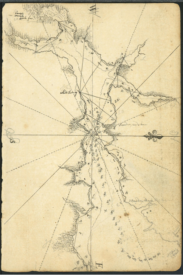
A handful of assistant surveyors and other staff came from the civilian world but the army and navy provided the bulk of the manpower. The army detached sixteen men from the 60th to serve on the surveying parties. Since most of the work would be along shorelines and depth soundings had to be taken, the Admiralty refitted and armed a merchant ship named Canceaux, provided a number of whale boats, and furnished a crew ultimately reaching forty-five men commanded by Lt. Henry Mowat.[12] Over the course of the survey, Holland acquired some additional tenders to assist the Survey.[13]
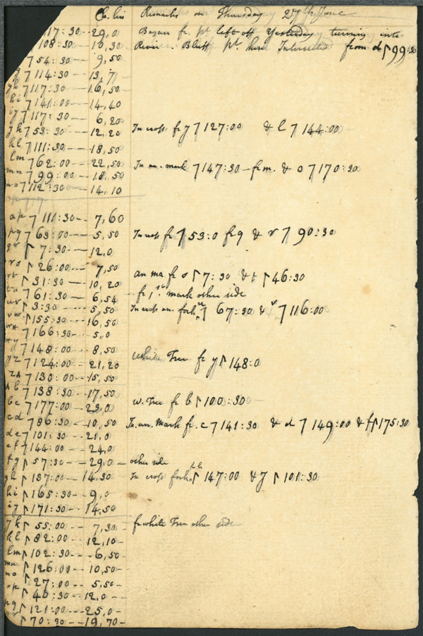
The wide variety of instruments came from the best makers in England. The list included the latest in surveying equipment but also several instruments with which to make astronomical observations and to determine latitude and longitude.[14] The teams used tents in the field but they often had to be repaired or replaced with canvas from the used sails of the ships.[15]
The new Surveyor-General brought all this news with him when he returned to Quebec in July, 1764. His earlier work and new assignment so impressed Governor Murray that he appointed Holland to the Quebec Council and made him a justice of the peace.
Teams then moved on to Anticosti Island and a survey of both sides of the St. Lawrence River. Now four years into the General Survey, Holland had not heard from the Board of Trade for months and had begun to use his own money to support the Survey. In addition, two of his assistant surveyors requested leave to return to England and another (the nephew of Frederick Haldimand, future governor of Canada), drowned on Cape Breton. All this prompted Holland to write that he had become “tired of surveying.”[20]
The next year seemed to bring a change in attitude. Holland felt honored to be asked to serve on a commission determining the boundary between New York and New Jersey and, using his skills as an astronomer, to take measurements of the transit of Venus across the face of the sun.[21] Being sure not to neglect the General Survey, on the way to New York from Quebec City, he left a party at Ticonderoga to survey from there to Albany.[22]
Frustrations resumed with his return to Quebec. He learned that J.F.W. Des Barres, assigned by the Admiralty to survey Nova Scotia (including today’s New Brunswick), would not be doing the east coast. Holland had to find the time and men for that job. He also learned that Lieutenant Mowat had not completed his tasks of taking soundings and creating sailing instructions for the Gulf of St. Lawrence. Further, the 60th Regiment would be transferred to the West Indies, making paying and supplying his men problematic.[23] In spite of these challenges, in a bit over five years, Holland and his team completed a detailed survey of the northeastern coast of Canada amounting to 5,000 miles of shoreline.
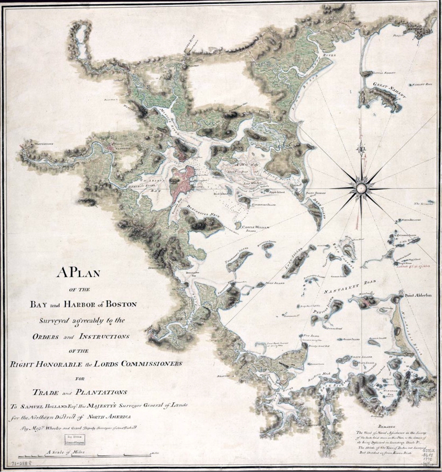
Next came surveying the coast from St. John through New England. With the Canceaux headed back to England for a refit, Holland could not easily move or supply his teams so he divided them up with long-term assignments: one worked out of Casco Bay in Maine, another surveyed the Connecticut River, and the third surveyed the Piscataqua River area.
The coast of Maine provided the surveyors with an uncompromising problem—a seemingly endless number of harbors, inlets, and islands. Surveying the irregular coastline and islands covered upwards of 5,000 miles. Already far behind schedule in 1772, it took until the fall of 1773 to complete the work.
The results impressed the home government. The Colonial Secretary wrote Holland, “I have the Satisfaction to acquaint you that it has met with His Majesty’s Approbation.” The king had such a favorable opinion that the map ended up in the King’s Topographical Collection.[24]
Realizing the value of New England’s resources, particularly pines for masts, Holland proposed an alteration in the borders between New Hampshire, Massachusetts, and Nova Scotia. The changes would create a province called New Ireland containing the best sources of naval supplies. Most importantly, it would be under the control of the home government rather than colonial legislatures. While the plan had supporters, it would never be seriously considered.
At the same time, Holland suggested to New Hampshire’s Gov. John Wentworth that the province be surveyed using astronomical calculations to determine boundaries. Begun in early 1772, the work took until 1774 but resulted in a very detailed map.[25]
General Thomas Gage, the commander of the army in North America, knew of Holland’s work. In the wake of the 1765 Stamp Act troubles he had made some unsuccessful efforts to have accurate maps of the colonies created. He asked Holland to survey the Massachusetts interior, writing, “there is no map of the inhabited provinces of any use . . . even the roads are not marked.”[26] Unfortunately, Gage did not send the request to the Board of Trade who, in any case, had fixated on surveying the coasts of the areas taken during the last war. Within a year of the New Hampshire survey, Gage’s army would begin a major conflict with very limited knowledge of the land over which they would fight.
Nor did the navy benefit much from Holland’s work. Lieutenant Mowat and the Canceauxhad provided invaluable assistance in transporting and supplying the survey teams but had not been thorough in taking soundings. While the maps of the coast contained great detail, the incomplete soundings made those charts of limited naval value.
Holland had not been all business during his years of surveying. He bought a house and property in Sainte-Foy near Quebec City in 1768 and had acquired land on the Island of St. John and later in New Hampshire and what would become Vermont. All these purchases and using his own money to support the Survey strained his finances so, to keep up with these expenses, he began selling off some of his holdings. In 1772, he sold his captain’s commission, retired from the army, and settled in Portsmouth, New Hampshire.[27]
Holland soon became friends with Governor Wentworth. Although there is no evidence that Holland and Geertruy ever received a divorce decree, there is documentation that courts in New Hampshire legitimized a marriage with Josephte. Details are unknown but prior to 1772, Holland never referred to Josephte as his wife. Following that, there are several instances of him using that term when talking about her.
Surveying continued to occupy Holland’s time. He worked on the boundary between New York and Pennsylvania and a survey of Massachusetts. In 1773, he wrote to Dartmouth suggesting the creation of an atlas based on the new surveys. Admiralty surveyor Des Barres had the same idea and Holland shared much of his work with him.
Antagonism between the American colonies and the government in England began to worsen in 1774. Even though they were surveying parts of Massachusetts, the region with the most hostile anti-government activity, Holland and his team worked unmolested. Holland wrote that “most persons of sense know the utility of our Business.”[28] Nevertheless, Admiral Thomas Graves ordered the Canceaux to anchor in the Piscatagua River to protect the custom house and provincial treasury. Through the use of smaller tenders, the ship continued to supply the survey teams.[29]
Tensions eventually had their impact. The ship never fully returned to Holland’s employ and he had to cease all activity by the end of 1774. In a few months, any hopes for continued work on the Survey would fade away due to the change from a war of words to that of bloody combat.
Realizing the skill and knowledge possessed by Holland, the rebelling colonists offered him commissions as chief engineer and master of artillery. Viewing the colonists as “an Ignorant Populace,”[30] he turned down the offer with “indignation and contempt” and sailed for England.[31]
Shortly after the opening of armed conflict, Holland sent Gage drafts of his maps of eastern Massachusetts. Too little, too late for the British in Boston but, apparently, some of those maps ended up in General Washington’s hands: Richard Gridley enclosed Holland’s map of Cape Ann in a letter to the general.[32]
Holland returned to New York in April 1776 with a new commission and assignment. Now a brevet major (a staff rank with no combat command), he served as an aide to Hessian Gen. Leopold de Heister and would work with a new unit called the Guides and Pioneers. Joined by a handful of his General Survey members, the group gathered geographic intelligence, made maps, topographical surveys of population centers, and, at times, conducted espionage missions to gather information. As part of the Guides and Pioneers, Holland produced a map of the capture of Forts Montgomery and Clinton by the British in October 1777.[33]
Holland left the Guides and returned to Quebec in 1779. Haldimand had recommended to Lord North that the major be appointed muster-master general of the German troops. He included a recommendation from de Heister and suggested his knowledge of German would prove quite useful. The approval came back quickly.[34]
Once settled in his new jobs, Holland took the time to petition to have back pay from 1766 given to him.[35] It would take until 1788 to settle the account. Around this time a regular expense ended—support payments to his former wife, Geertruy, which he had been sending her for nearly twenty years.[36]
Surveying and mapping continued to occupy some of his time. He worked on determining the boundary of the king’s land in Montreal and prepared a map of the terrain from Montreal to the upper Connecticut River, an area suspected to be an invasion route for the Americans.[37] He also surveyed and prepared a report on the potential of the land between Niagara and Cataraqui, modern Kingston, Ontario, as area which provided major settlements for Loyalists fleeing the new United States. Holland would play a major role in surveying more townships in Ontario, helping to get Loyalists settled, and resolving disputes.
Age and the physical demands of surveying took their toll by 1789. In October, Holland suffered a stroke that limited his speech and paralyzed his left side. Although he experienced some recovery, the stroke left him with a debilitating palsy which limited his ability to perform his job. Another stroke in 1792 compounded his problems. He continued to serve as Surveyor-General but his financial situation deteriorated over the years.
Major Holland died at his home in Quebec on December 28, 1801. His family buried him with military honors on his property alongside his namesake son who had been killed in a duel.[38] In 1804, Josephte moved to her property on Lot 28 (now Tryon), Prince Edward Island. She died in 1825 and is buried in Tryon.
Under Holland, the General Survey, even in incomplete form, proved quite influential. Alexander Johnson in his doctoral dissertation writes,
Holland and his deputies raised the standards for the scientific topographical map by adding extensive observations on the manmade features of the landscape, thereby producing the most detailed and accurate economic maps made during the colonial era. This highly sophisticated cartography not only assisted traditional purposes, such as demarcating boundaries and facilitating navigation, but also provided administrators in both London and America with a most comprehensive source of intelligence for making policy decisions related to infrastructure, taxation and resource management.[39]
In addition to highly accurate maps and textual reports, the Survey created a further aid to navigation and colonial management. Throughout the work, Holland had used his astronomical skills and exquisite equipment to take the necessary measurements for fixing the longitude of several major locations.
Fixing the graticule of parallels and meridians was absolutely essential, for it was the lattice upon which everything else was located. The creation of this abstract space, carefully calculated from observations of the planets, was necessary for fixing local points measured by triangulation. Local places were now embedded into a universal geometric framework. . . . More importantly, colonial spaces in North America were bound through the Greenwich meridian to the cartographic space of Britain.[40]
Such information allowed ships to more easily navigate the oceans and assisted the Board of Trade in their decision-making.
Furthermore, the Survey set England on the path to becoming the world leader in cartography. England lagged far behind most European countries who, by the early eighteenth century, had departments dedicated to geography and cartography. The army formed the Ordnance Survey in 1791 and the Admiralty created the Hydrographic Office in 1795. By the time of those belated actions, England had reversed her standing — largely due to Holland’s work.
During his lifetime and for many decades following, people recognized the name Samuel Holland. Much of his work reached the public through The Atlantic Neptune. Appearing in several editions, the largest had 115 maps in five volumes. Assembled by J.F.W. Des Barres, Northern Survey maps accounted for most of Volume 2 (New England) and Volume 4 (Gulf of St. Lawrence). While Des Barres gave Holland credit, it is not difficult to imagine Holland feeling a bit miffed that Des Barres received most of the notoriety. He could be proud, however, that publishers like Jefferys and Faden published many of his maps and the data he collected.
Today, outside of Prince Edward Island, Samuel Holland’s name is seldom recognized. He and his work deserve better.
[1]Holland’s notebook is in the collections of Dalhousie University, MS-2-33, SF Box 16, Folder 1.
[2]Sayer and Jefferys published the map in 1768: see Library of Congress maps, www.loc.gov/item/74692648/.
[3]The map has since been lost.
[4]JamesWolfe to Duke of Richmond, July 28, 1758, in Carver, ed., “Wolfe to the Duke of Richmond: Unpublished Letters,” 23, 37. Quoted in Earle Lockerby and Douglas Sobey, Samuel Holland: His Work and Legacy on Prince Edward Island (Charlottetown, PEI: Island Studies Press, 2015),5. The Board of Ordnance established the Corps of Engineers in 1716. Regiments frequently had “assistant engineers” on their staff but they did not belong to the Corps. Holland never did gain membership in the Corps.
[5]This large-scale map can be seen on the Library and Archives Canada website, recherche-collection-search.bac-lac.gc.ca/eng/Home/Record?app=fonandcol&IdNumber=4151402.
[6]The map can be seen at www.loc.gov/resource/g3312s.ar023400/.
[7]Thomas Holland to John Graves Simcoe, June 10, 1792, “John Graves Simcoe Papers,” file 24, no. 18, 1-5. Qouted in Lockeby and Sobey, Samuel Holland, 9. There continues to be considerable debate about those around Wolfe when he died.
[8]The complete map is forty-five by thirty-six feet. Rather than one massive sheet, the finished product consisted of forty-four smaller sections. It can be seen at recherche-collection-search.bac-lac.gc.ca/eng/home/record?app=fonandcol&IdNumber=4134077.
[9]Transcribed in Adam Shortt and Arthur Doughty, Documents Relating to the Constitutional History of Canada 1759-1791, Part 1 (Ottawa: J. de L. Taché, 1918), 50.
[10]The second son had future governor of Canada Frederick Haldimand as godfather and the tenth child had Hessian Brig. Gen. Ernst Ludwig Wilhelm von Speth fill that role.
[11]Alexander James Cook Johnson, “Charting the Imperial Will: Colonial Administration & the General Survey of British North America 1764-1775” (PhD diss., University of Exeter, 2011),76.
[12]Stephen J. Hornsby, Surveyors of Empire: Samuel Holland, J.F.W. Des Barres, and the Making of “The Atlantic Neptune” (Montreal; McGill-Queen’s University Press, 2011), 95-6.
[13]Henry Mowat, Voyage of the Canceaux 1764-1776: Abridged Logs of H. M. Armed Ship Canceaux, ed. Andrew J. Wahll (Berwyn Heights, MD: Heritage Books, 2019), 52, 161, 202, 209.
[14]“Memorial to Commissioners for Trade and Plantations,” The National Archives, UK (TNA), CO 323/17, 63-65v. Quoted in Lockerby and Sobey, Samuel Holland, 27. The latitude and longitude measurements have been found to be accurate within 0.5 percent.
[15]Mowat,Voyage of the Canceaux, 125, 139, 201.
[16]Holland to Thomas Pownall, 4 March 1765, TNA, CO 323/18, 111-112v. Quoted in Lockerby and Sobey, Samuel Holland, 24.
[17]Hornsby, Surveyors of Empire, 105-7.
[18]At a scale of 4,000 feet to the inch, the map measures just over nine feet by thirteen feet in twenty-four sections. Restored by The National Archives in England and displayed in Charlottetown, PEI, for the map’s 250th, a view can be downloaded at Canadian Geographic, canadiangeographic.ca/articles/remembering-peis-first-modern-cartographer/#&gid=1&pid=1.
[19]Holland to Lord Hillsborough, January 10, 1767, Coventry Papers, 241-246. Quoted in Lockerby and Sobey, Samuel Holland, 147.
[20]Holland to Haldimand, January 20, 1768, Haldimand Papers, University of New Brunswick,68/213.
[21]Measurements taken from several observation points around the world allowed the distance between the Earth and Sun to be determined.
[22]Holland to Hillsborough, October 15, 1768, TNA CO 5/71, pt. 1. Quoted in Hornsby, Surveyors of Empire, 64.
[23]Arrangements to keep the men with Holland would be made. See Haldimand Papers,5/191; 33/132; 35/26, 38; 70/70, 123, 263.
[24]Lord Dartmouth to Holland, February 5, 1774, TNA CO 5/75, ff 25-6. Quoted in Johnson, “Charting the Imperial Will,” 347. View the king’s topographical collection at www.flickr.com/photos/britishlibrary/albums/72157716220271206/.
[25]This map can be viewed at www.loc.gov/resource/g3740.ar087300/. Holland developed a close relationship with Dartmouth College in what is now Hanover, New Hampshire. In 1774, he gave the college a finely-made sundial.
[26]ThomasGage to Holland, July 27, 1767. Clements Library: Gage Papers, American Series, vol. 66. Quoted in Johnson, “Charting the Imperial Will,”254-5.
[27]Hugh Wallace to Haldimand, September 30, 1772, Haldimand Papers,19:96.
[28]Holland to Haldimand, June 13 1774, Haldimand Papers,71/220, 176.
[29]Mowat, Voyage of the Canceaux, 252, 254.
[30]Holland to Haldimand, June 13 1774, Haldimand Papers,71/220, 176.
[31]“Memorial of Samuel Holland,” November 22 1783, TNA AO 13/13, f287. Quoted in Hornsby, Surveyors of Empire, 84.
[32]Papers of the Continental Congress, “Miscellaneous Letters Addressed to Congress, 1775-89,” 10:21. Map:Holland, Samuel, Henry Mowat, and P. D’Auvergne, A plan of the harbour and peninsula of Cape Ann in North America, www.loc.gov/item/gm71005447/.
[33]The map can be viewed at www.loc.gov/resource/g3804f.ar118900/.
[34]Haldimand to Lord North, June 18, 1779, Haldimand Papers,66/141. Treasury to Haldimand, July 30, 1779, Haldimand Papers,46/151.
[35]Haldimand to Treasury, October 25, 1782, Haldimand Papers,59/123.
[36]Lockerby and Sobey, Samuel Holland, 148.
[37]Friedrich Riedesel to Haldimand April 2, 1782, Haldimand Papers,137/64. A possible copy of the map can be viewed at www.loc.gov/item/gm71000890/. Although Holland’s name does not appear on this map, it is likely a copy of his map used to depict the route followed by a British scouting party.
[38]The site of the graves is now on an elementary school grounds and private property.


One thought on ““The Utility of Our Business:” Samuel Holland, Surveyor-General”
I had the good fortune to find this article while investigating the wish of Samuel Holland, having completed his coast survey westward as far as Boston, to move operations to Perth Amboy, N.J. This is set out in a letter dated Portsmouth, N.H., 15 November 1773, of which the text was printed in the Newark Sentinel of Freedom of 19 April 1842.
Do you have any knowledge of this letter and where the original may be found?