On late summer days, sailboats of all sizes dot the Hudson River like so many white specks against a blue-gray background. But when the changeable weather of October arrives the river can become an unpredictable waterway, covered in mist or heavy fog. In the Hudson Highlands, a majestic series of mountains beginning about a third of the distance from Upper New York Bay to Albany, variable winds, strong tidal currents and changing courses add to the navigational hazards. During the American Revolution, in the Hudson Highlands’ theater of operations, terrain took top billing.
The opposing forces knew the strategic value of the Hudson River corridor in general, and Hudson Highlands in particular. The British ministry intended to divide the Colonies and suppress the conflict by commanding the Hudson with “a number of small men-of-war and cutters, and maintain[ing] a safe intercourse and correspondence between Quebec, Albany, and New York.”[1] George Washington believed it was “the only passage by which the Enemy from New York or any part of our Coast, can ever hope to Cooperate with an Army that may come from Canada…the possession of it is indispensably essential to preserve the Communication between the Eastern, Middle and Southern States…”[2]

In the fall of 1775, New York’s Provincial Assembly first suggested to the Continental Congress that the Highlands be fortified.[3] Bernard Romans, Dutch surveyor and engineer, was employed to plan a defense system. He chose World’s End, a tight S-bend in the river under which lie “the bones of hapless sailors and the rotted hulls of round-bottomed sloops…”.[4] It was the perfect gauntlet but instead of utilizing both banks, Romans limited his efforts to Martelaer’s Rock. He viewed the western shore (i.e. West Point) as having too many drawbacks to overcome. The Continental Congress accepted his proposal to build batteries, redoubts and other defensive emplacements but he soon ran into problems of budget, insufficient workers and inadequate supplies.[5] The Martelaer’s Rock initiative turned out to be “ill-planned and ill-situated” and the misguided effort ended in near disaster.[6]
In January 1776, Congress recommended to New York’s Committee of Safety that work at Martelaer’s Rock be phased out and that batteries at Popolopen’s Kill should be built by the continental troops that were to be stationed there.[7] Before Engineer Romans could begin in earnest on the replacement site, he ran into difficulties with local officials culminating in an assessment by Washington’s representative, William Alexander, Lord Stirling, that Romans had “displayed his genius at a very great expense and to very little publick advantage. The works in their present open condition and scattered situation [at Martelaer’s Rock] are defenseless; nor is there one good place on which a redoubt may be erected that will command the whole…”[8] Stirling also noted that the future Fort Montgomery site had a “slight problem”: across the creek, there was a point of land just two hundred yards to the south, projecting farther into the river at a higher elevation and with an acre-size area on which an enemy installation could menace the fort. Stirling concluded that this promontory should be fortified to threaten northbound ships and cover the heavily armed Fort Montgomery. Work began almost immediately on Fort Clinton, Fort Montgomery’s protective twin.
The vista that greeted the Continentals and militia as they arrived to build the Twin Forts was breathtaking. The newly formed 5th New York Regiment was ordered to build, mount cannon for and garrison the sites. On the river side, the Twin Forts were virtually impregnable, perched on high, rocky cliffs. To attack from the landward side, the closest suitable landing was Kings Ferry and once ashore the enemy would have to trek some five miles to the north through exceptionally difficult terrain over an unimproved road that was more like a wooded path. Nevertheless, the forts were designed to be defendable from the landward sides as well.
While the forts were under construction, the Orange County Militia did their best to patrol eighteen miles of shoreline, subjecting enemy gunboats to artillery and musket fire.[9] Some boats were foraging and sounding the river depth toward the Highlands, from which Washington concluded “they will attempt to pass with part of the Fleet if possible.”[10] But throughout 1776 the militia was just a modest annoyance and enemy bombardment of rebel homesteads and occasional landings to take the rich produce and livestock of rebel farm families continued south of the Highlands.
As the country began to awaken from the harsh winter of 1776–1777, the Hudson River had become General Sir William Howe’s oyster. In late March he raided Peekskill, about forty-five miles from New York and situated at the beginning of the Hudson Highlands. General Arthur McDougall with his small force of defenders withdrew, enabling the British to burn barracks, several mills and houses and a large store of supplies. Rebel reinforcements were eventually able to drive the British back to their ships.[11] While the action was a minor one, it may have made an indelible impression on General Israel Putnam who would soon be appointed Commander in the Highlands..
Farther south, Washington watched and waited in Morristown, NJ. He thought Philadelphia could be Howe’s next move but with General John Burgoyne’s army moving on Fort Ticonderoga at the southern end of Lake Champlain in early July, Washington was “almost certain” that Howe intended the long expected, much heralded link-up with Burgoyne to seal off the Hudson River.[12]
Washington positioned his army to move in that direction if Howe’s fleet headed into Upper New York Bay. On July 10, when he got word of the fall of Ticonderoga, he put his army in motion toward the Highlands although the fleet remained at anchor. By the 19th, he still didn’t know Howe’s intentions but he wrote that whatever they may have been before Ticonderoga fell, “[Howe] certainly ought in good policy to endeavour to Cooperate with Genl. Burgoyne.”[13] In consequence of his belief, he moved within eight miles of the river crossing to Peekskill. Then a lightning bolt hit: Howe had put out to sea with Philadelphia as the likely objective and Washington was well out of position.
Washington moved quickly to march his army south again. As correspondence written in late July and August shows, he was still uncertain as to where Howe would materialize. At first, he sent reinforcements to Putnam as a hedge against a Highlands coupe de main but by late August he was ordering those reinforcements back to Philadelphia to contest Howe’s confirmed landing near Head of Elk.[14]
Despite the attention paid to the Hudson River by nearly everyone, including Burgoyne, Howe had chosen to move south. In his later spirited defense before the House of Commons he claimed that moving on the Capital and the seat of Congress was more likely to draw Washington into a general engagement and would be more productive to end the war than sailing the Highland gauntlet to provide support to Burgoyne. Howe believed Burgoyne could take care of himself.[15] He left Sir Henry Clinton to protect New York but with leave to act offensively should the opportunity arise. It wouldn’t be long before Sir Henry saw that “opportunity.”
The Hudson Valley was brimming with anticipation, fueled by Washington’s continuing concerns that the British might still try to support Burgoyne. Construction activity at the Twin Forts continued at a steady pace but, as Israel Putnam complained to Congress, the forts were “poorly Man’d” and Washington’s requisition of 2,500 troops to join him near Philadelphia had been a hard blow.[16]
In late September, Clinton had the reinforcements he needed to support Burgoyne.[17] By this time, however, Burgoyne had suffered a setback at Bennington, disruption of his supply line, loss of local and Native American support and a Pyrrhic victory at Freeman’s Farm.
The Americans were uncertain whether Long Island Sound or Hudson River was Clinton’s objective but by October 4 the question was settled: Sir Henry’s flotilla was heading north to support Burgoyne. Clinton’s plan was masterful, complete with a series of feints intended to obscure the real target and hold the attention and presence of commanding general, Israel Putnam, on the eastern shore. Putnam may have been predisposed to believe he was the main target, with lingering memories of the March raid on Peekskill. He ordered additional troops from the Twin Forts, leaving only 600 men to cover the two positions.
On leaving New York, one British division headed for Tarrytown by land appearing to be a foraging force while the other troops remained with the transports. The following morning, having loaded all the men back on the transports, the convoy quickly made its way to Verplanck’s Point, several miles below Peekskill and the primary river crossing for the supply line running from New England to the Mid-Atlantic colonies. Instead of contesting the landing, Putnam withdrew his forces to Fort Independence, three miles above Peekskill, and awaited the main thrust.
On the dark night of the 5th, Clinton withdrew most of the landing force, reloaded them on assault boats and prepared to land the main body on the western shore. It was none too soon. That day, Burgoyne’s plight seemed virtually hopeless as he informed Clinton he’d hold out until the 12th, at which time he’d be forced to begin a retreat. Clinton, though obliged to continue, was hardly sympathetic.[18] He ordered another diversion at midnight, sending some of his ships north to menace Peekskill and Fort independence and interdict any attempt on Putnam’s part to send reinforcements to the Twin Forts. ‘Old Put’ stayed put.

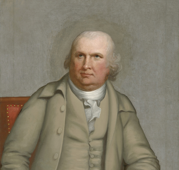
As morning approached, a ghostly fog concealed the river, muting and dampening the colorful fall foliage. Clinton’s forces rowed the short distance to Stony Point while a smaller force remained on the eastern shore to further bedevil Putnam. With Clinton was Beverley Robinson, a wealthy American Loyalist, who knew the Highlands well. To achieve surprise, Robinson identified a primitive road to the Twin Forts over changing elevations and rocky ground, through thick woods over a narrow road, hardly able to accommodate a column of three abreast.
About the same time the British were landing, an American reconnaissance party of 100 men from Fort Clinton was moving south, halting at Timp Pass in the mountains. A smaller detachment continued toward Stony Point and was eventually able to make out shadowy shapes of the enemy coming ashore through the swirling mist. Unable to determine their number they quickly returned to Timp Pass and reported. Although some wanted to fortify the perfect chokepoint, the men returned to Fort Clinton.[19] This was, perhaps, a tactical mistake. The Americans, familiar with the terrain, could have blocked the road, posted ambushes above and in front of the main body and sought reinforcements from the Twin Forts. The British would have been considerably hampered by the poor visibility and the tight quarters thereby offsetting the numerical odds. At the least, the delaying action would have defined the attacking force, affected morale, inflicted some casualties and enabled Putnam to appreciate the need to send reinforcements. Fortunately for the British, when Clinton reached Timp Pass it was deserted.
Action soon began when another rebel scouting party confronted the Redcoats where the road forked in the hamlet of Doodletown. Hearing the musket fire, newly elected New York Governor George Clinton, commanding the Twin Forts, sent reinforcements and a brief skirmish ensued along a nearby stone wall. When the rebels withdrew to Fort Clinton, an uneasy quiet descended as Sir Henry divided his force: 900 men trudged around Bear Mountain to attack Fort Montgomery in the rear while 1200 more waited to simultaneously storm Fort Clinton.
The Twin Forts battle was heroic: British tactics and superior numbers met a stubborn American resistance against forces three times their size. The incomplete defensive works, poorly situated and comparatively open on the landward sides of the forts, helped doom the defenders despite the 5th New York’s inspired last stand.[20] At least as damaging as the faulty construction was a hopelessly befuddled General Putnam, still wondering where the enemy was until it was too late. At about 8 PM it was over. In the gloomy darkness some Americans, including Governor Clinton, managed to flee.
One can’t consider this battle without reviewing the decisions of Generals Putnam and Washington. Putnam’s leadership was indecisive, even non-existent, and blame for the debacle should rest squarely on his shoulders. While the enemy was in the midst of their Stony Point landing, Putnam was writing to the President of the Congress, already claiming that he not only was unable to defend the Highlands but couldn’t be blamed should there be a defeat.[21] Yet this wasn’t enough. He also wrote Washington to say “I have repeatedly informed your Excellency of the enemy’s design against this post; but, from some motive or other, you always differed with me in opinion.”[22]
Washington answered Putnam’s complaint about having to send 2,500 reinforcements to Pennsylvania by writing that he “consulted those best acquainted with the Strength of the passes and they all agreed, that about two thousand Men at Peeks Kill and Fort Montgomery would be sufficient to repel any force that would probably be sent against you.” Putnam’s blood pressure may have risen when he read “I think you will find that you have far over rated Genl. Clinton’s force at New York, I am certain you have in regard to the late Reinforcements.”[23] Washington did draw forces away from the Highlands which were sorely needed. However, had Putnam not been frozen in place but more pro-active about reconnoitering the enemy’s movement on the eastern shore and had he withdrawn what he considered to be his exposed forces farther north to be in closer support of the Twin Forts the rebel forces may have been able to frustrate Clinton’s offensive sufficiently to avoid the additional havoc caused by the British after the Twin Forts defeat.
In a confidential letter to Washington, Governor Clinton criticized Putnam. With “prudent management,” the Twin Forts would have commanded the river and forced the British to attempt Burgoyne’s deliverance by land. That, the Governor argued, would have led to the destruction of General Clinton’s whole army. Gov. Clinton never considered Peekskill very important by itself to the defense of the river, especially because Putnam’s misjudgments left Forts Clinton and Montgomery and the State Capital, Kingston, in danger.[24]

At Midnight, Governor Clinton, Putnam and other generals all felt that Sir Henry would now move to relieve Burgoyne before it was too late. They decided to withdraw what they could from Continental Village and move to the better fortified village of Fishkill. Incredibly, the British waited four days before they sent their relief force toward Saratoga, during which time they managed to destroy the still well-stocked Continental Village and forage at an undeveloped place called West Point. Finally on the 11th, just one day before Burgoyne’s self-proclaimed deadline for retreat, a 2000-man force under Major-General Vaughan sailed to rescue Burgoyne’s once-grand northern army. Calm winds delayed Vaughan until the 16th when he made it to Kingston and burned the entire town. A day later, while Burgoyne was handing his sword to General Gates, Vaughan began a week of laying waste to more riverbank houses and farms of Patriot families.[25] On October 25, having confirmed Burgoyne’s surrender and determined that the cost in men and supplies would be too much to hold the Twin Forts, the British got into their ships and quietly sailed south.
The Battle of the Hudson Highlands isn’t considered a major engagement of the war. Certainly, Burgoyne’s northern campaign transcended all other action from the moment Burgoyne took Ticonderoga until his army marched ignominiously off to Boston for transport home. Yet this wasn’t the end of the Hudson Highlands’ important role in the American Revolution. Lessons were painfully learned by Washington from Sir Henry Clinton’s adventure and a search for another location to control the river would soon begin. The result would have lasting impact on the new nation.
[1] E. M. Ruttenber and L H. Clark, History of Orange County, N.Y., (Philadelphia: Everts & Clark, 1881), 56.
[2] George Washington to Israel Putnam, December 2 1777, The Writings of George Washington from the Original Manuscript Sources, 1745-1799. Ed. John C. Fitzpatrick, Library of Congress, (hereafter referred to as “WGW”), Series 3b Varick Transcripts, http://memory.loc.gov/cgi-bin/query/r?ammem/mgw:@field(DOCID+@lit(gw100143)) accessed September 14, 2013.
[3] Journal of the American Congress, 1774 – 1788, Vol. I (Washington: Way and Gideon, 1823), October 7, 1775, 150.
[5] Benson J. Lossing, The Pictorial Field-Book of the Revolution Vol. II, (New York: Harper, 1852), 135. Martelaer’s Rock was later named Constitution Island on which Romans’ Fort Constitution began construction.
[6] William H. Carr and Richard J. Koke, Twin Forts of the Popolopen: Forts Clinton and Montgomery, New York 1775 – 1777, Historical Bulletin 1, (Bear Mountain, NY: Commissioner of the Palisades Interstate Park and the American Scenic and Historic Preservation Society, 1937), 10; Francis A. Galgano, “The Revolutionary War in the Hudson Highlands: Fortifying West Point, 1775-1779.” Middle States Geographer, 43: 2010, 64.
[8] Lord Stirling to George Washington, June 1, 1776, Peter Force, American Archives Fourth Series, vol. VI (Washington: M. St. Clair Clarke and Peter Force, 1846), 672-674.
[9] Robert A. Mayers, The War Man, The True Story of a Citizen-Soldier Who Fought From Quebec to Yorktown, (Yardley.PA: Westholme Publishing, 2009), 44.
[10] George Washington to Continental Congress July 17, 1776, WGW, http://memory.loc.gov/cgi-bin/query/r?ammem/mgw:@field(DOCID+@lit(gw050264)) accessed August 27, 2013.
[11] James Thacher, MD, A Military Journal during the American Revolutionary War, from 1775 – 1783, (Boston: Richardson and Lord, 1823), 93. For the more graphic British officer’s version from Gaine’s Mercury, March 31, 1777, see Frank Moore, Diary of the American Revolution, Vol. I, (New York: Charles Scribner, 1860), 411-413.
[12] George Washington to Israel Putnam July 1, 1777, WGW, http://memory.loc.gov/cgi-bin/query/r?ammem/mgw:@field(DOCID+@lit(gw080288)), accessed September 14, 2013.
[13] George Washington to William Heath July 19, 1777, WGW. Series 3b Varick Transcripts, http://memory.loc.gov/cgi-bin/query/r?ammem/mgw:@field(DOCID+@lit(gw080377)) accessed September 14, 2013.
[14] George Washington to Israel Putnam August 1, 1777, George Washington to John Sullivan August 1, 1777, George Washington to George Clinton August 1, 1777 and George Washington to Alexander McDougall August 1, 1777, WGW, and William S. Baker, Itinerary of General Washington June15, 1775, to December 23, 1775, (Philadelphia: J. B. Lippincott Company, 1892), 78-86.
[15] William Howe, The Narrative of Lieut. Gen Sir William Howe in a committee of the House of Commons, (London: H. Baldwin, 1780), reprod. by ECCO, 21-24.
[16] Israel Putnam to John Hancock, September 29, 1777, Correspondence and Journals of Samuel Blachley Webb, Vol. I 1772-1777, Ed. Worthington Chauncey Ford, (Lancaster: Wickersham Press, 1893) (hereafter referred to as “Webb”), 320.
[17] Sir Henry Clinton, The American Rebellion, Ed. William B. Willcox, (New Haven: Yale University Press, 1954), 72.
[19] Dave Richard Palmer, The River and the Rock, 2nd Edition, (West Point: The Association of Graduates, USMA, 1991), 106.
[23] George Washington to Israel Putnam October 7, 1777, WGW, http://memory.loc.gov/cgi-bin/query/r?ammem/mgw:@field(DOCID+@lit(gw080288)), accessed September 20, 2013.


6 Comments
Great read ! I’m currently reading up on this subject as I’ve found a note to my grandmother from her great aunt claiming she descends from both a Garrison and a Porter who were involved in the great chain across the Hudson!
If your Garrison heritage is related to the hamlet’s founders, you might want to check out:
http://archiver.rootsweb.ancestry.com/th/read/GARRISON/2008-10/1223047858
Thanks for the comment.
A fascinating piece with great analysis. I think this points to some themes that were consistent in some British efforts to control the Hudson; good planning followed by flawed execution. I am glad to see these actions addressed in detail.
Thanks, Mike. I couldn’t help but come away from the article with new respect for the British plan of attack and execution over a couple of days culminating in their attack on the Twin Forts. The path leading to the forts to this day is very rugged and bleak and the force led by Clinton was able to successfully traverse arduous terrain and move directly into a simultaneous attack on the two forts. I did get a copy of your book, read it and found it very helpful in appreciating what the British encountered in their trek inasmuch as Wayne made a more western approach but likewise over difficult terrain.
I enjoyed seeing some attention paid to the Highland Forts. I have an ancestor among the original recruits for the Loyalist regiment called the New York Volunteers. They were in Lt. Col. Campbell’s column in the attack on Fort Montgomery and fought on the left side of the Hessian regiment during the assault itself. The NY Vol commander Major Grant was killed in the action and the New York Volunteers lost more men than any other British unit. Serving from 1778 to 1783 in the southern campaign, they would later prove among the most reliable and respected of the Loyalist regiments.
In confession, I’m not an American History buff yet I was quite impressed with this article being extremely interesting, as well as suspenseful for a factual delivery. In addition, It offered a wonderful visualization of the rugged terrain and challenges of the Hudson and its environs, & captured well the persona of those involved in the Battle of the Hudson Highlands! Thank you.