

July 4th may be a time of festivities in the United States but on Prince Edward Island (PEI) it’s just another day with Canada Day celebrations falling on the 1st. Wanting to do something related to Independence Day, my wife donned her red, white, and blue (I didn’t have anything so colored) and we visited the 18th-century site of Port-la-Joye/Fort Amherst, a Parks Canada site in Rocky Point.
Along the south shore of an island the Mi’kmaq called Abegweit, three rivers joined to form a large harbor protected by a narrow channel into the strait between the island and the mainland. The harbor provided the Mi’kmaq with a location from which to conduct their fishing voyages but it also attracted the attention of European fisherman in the 16th and 17th centuries. Jacques Cartier officially “discovered” the island in 1534, claimed it for France, and named it Île St. Jean.
Over the next 200 years, the Mi’kmaq found themselves slowly pushed aside as France and England vied for control of what would become the Canadian Maritimes. In 1720, with France in control of Île St. Jean and Île Royale (modern PEI and Cape Breton), 300 settlers arrived from France to establish homesteads on the western side the harbor’s mouth. The settlement, named Port-la-Joye, became the capital of the Island.
For several years, Port-la-Joye struggled along never developing as planned but by 1740, over 400 people lived in the area. After the fall of Louisbourg in 1745, a force of New Englanders burned much of the settlement but, while pursuing the French, ran into an ambush losing a number of men. A second action occurred the following July when forty men from Fuller’s 29th Regiment and some New Englanders came under attack by a large party of Indians and Acadians (descendents of the original settlers of Acadia—modern Nova Scotia, New Brunswick, and parts of Maine). The English lost 34 men while killing only two of the attackers.

French settlers and soldiers came back to Port la Joye when the 1748 peace treaty returned Île St. Jean and Île Royale to French control. With tighter British control in the early 1750s prompting many to leave mainland Acadia and fugitives escaping from the 1755 Acadian deportations, the population of the settlement grew dramatically. Growth ended abruptly, however, with the fall of Louisbourg in July of 1758. Within three weeks, 500 British regulars arrived and began to round up settlers from all over the island—now called St. John’s Isle–for deportation. By October, over 3,000 Acadians from the Island, including most of those at Port-la-Joye, had been shipped away to various other British colonies and to France.
The British also began work on a new fortification which they named Fort Amherst. While not a large post, it did house 190 men. A dry ditch surrounded the rectangular fort with a drawbridge on one side. The walls had a sandstone foundation topped by a picket wall about eight feet high. Ultimately, each corner had four cannons and two of the walls had one piece mounted mid-way. Buildings included the commandant’s headquarters, officers’ and enlisted men’s’ quarters, storehouse, bakehouse, forge, and a prison.
Being at a frontier post in Acadia with little French presence left, life must have been quite boring. So boring, in fact, that some men smuggled in rum that prompted an investigation which turned up talk of mutiny. In the end, three men received sentences of 500 lashes, one received 1,000 lashes, and John Turner, the ringleader, received a death sentence.
With the 1763 Treaty of Paris, what little significance Fort Amherst had faded substantially and. over the next five years, the garrison gradually diminished. Eventually, in 1768, Charlottetown across the harbor became the capital of the province and what remained of the garrison moved out of the dilapidated Fort Amherst into the new Fort Edward.

After the deportations, many New Englanders moved north to settle on the former French holdings. Because of their origins, the region did show some support for the American cause in the years leading up to the Revolution. Once the war broke out, however, privateers began raiding the coastal settlements and, in November, 1775, one of those privateers entered the harbor and ransacked Charlottetown and the surrounding habitations, including those on the site of the former Fort Amherst. Support waned following those depredations but never completely disappeared. To this day, the Maritimes have a substantial connection with New England, particularly Boston. Many Maritimers say it’s stronger than that with the rest of Canada.
At the time of the Revolution, nothing remained of the fort but the ditch, collapsed walls, and cellar holes. Over the next 180 years, the land went through a number of owners who farmed it until 1959 when the Canadian park service bought it for a national park. The historic site officially opened in 1973.
Today, the grounds are maintained but the visitor center is closed, the victim of budget cuts. And therein lie the problems with the site—there is no museum showing artifacts from archaeology on the site, no orientation presentation, no ranger to answer questions, and (at times the most critical problem) the restrooms are down the road a couple hundred yards from the visitor center.
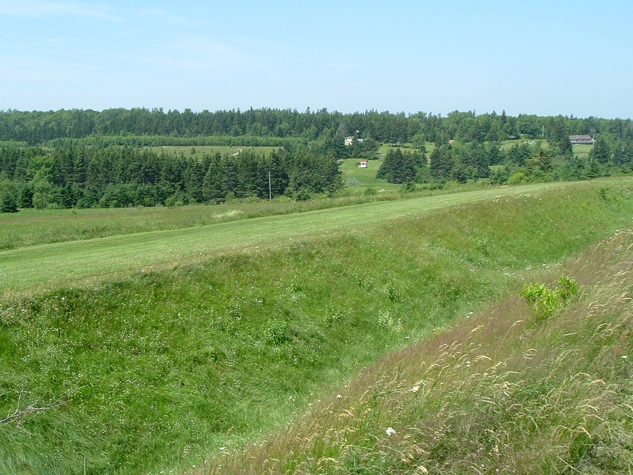
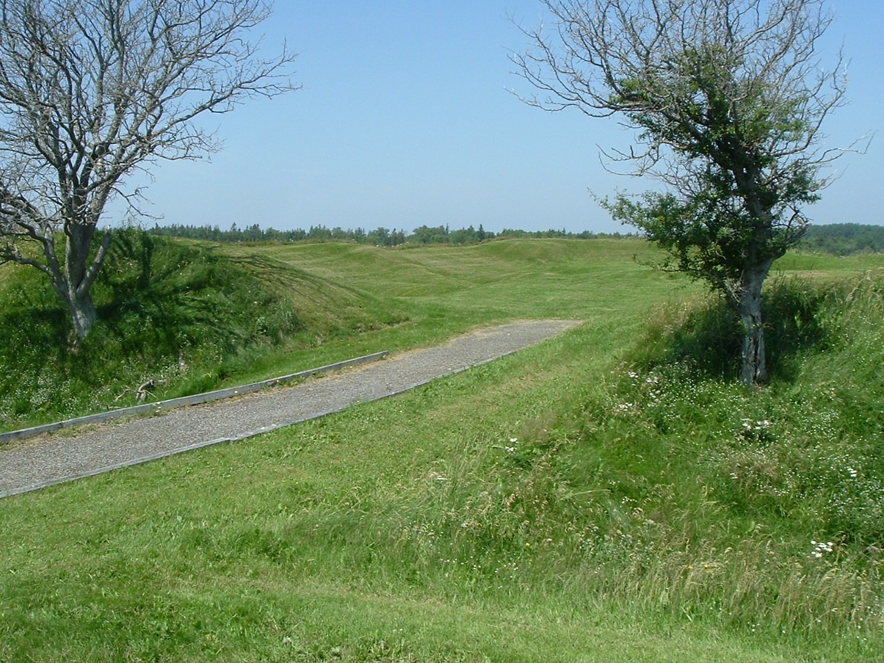
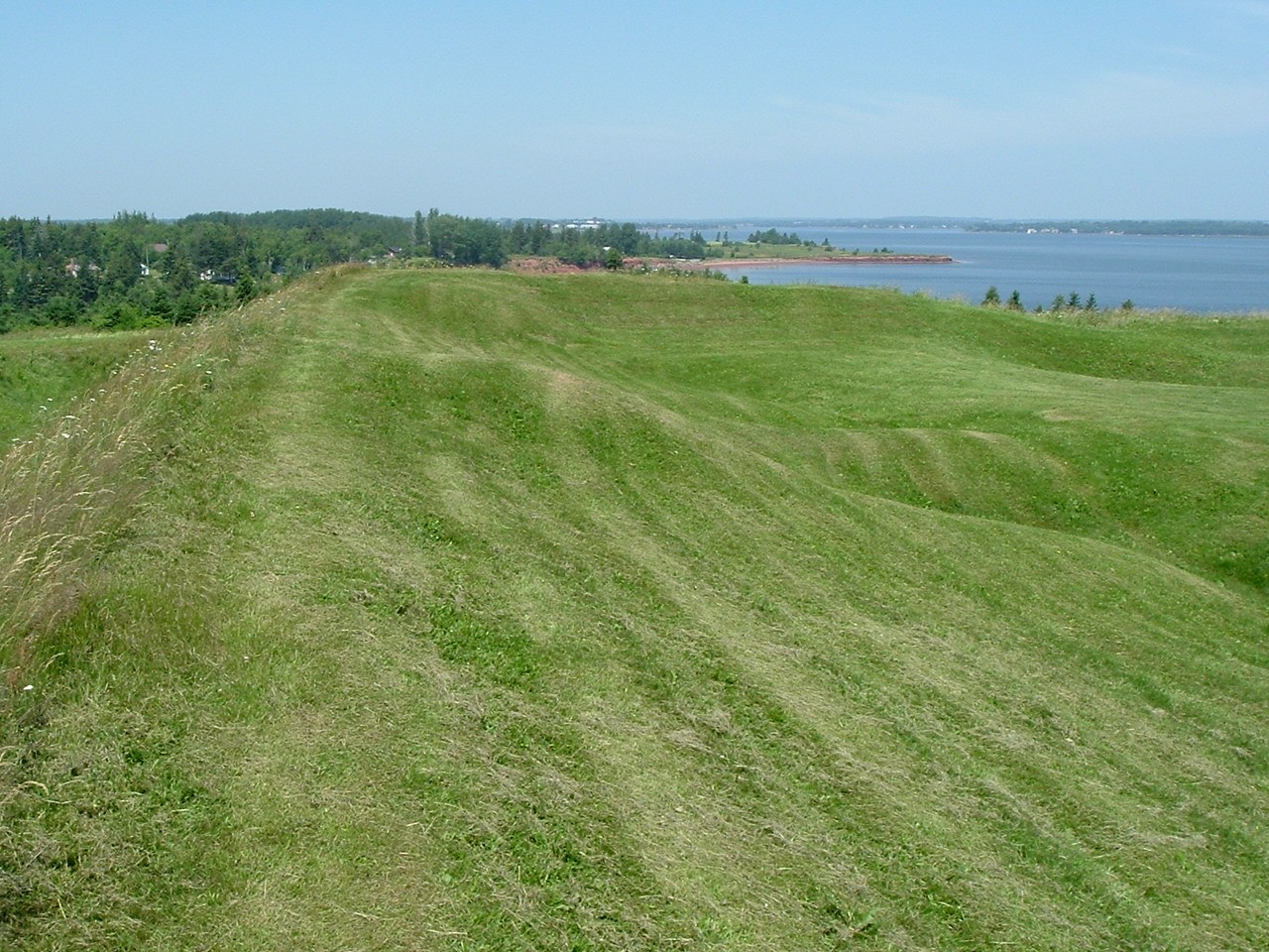
The self-guided tour, however, is reasonably well done—provided one has the motivation to walk and read. There are interpretive signs along the paths and the brochure (available in French or English) has an excellent map and a brief overview of the history. As well as the ruins of the fort, the 224-acre site features several hiking trails (all handicap accessible) and there are large picnic and activity areas. Being on relatively high ground, there are very nice views of the harbor, the city of Charlottetown, and the surrounding countryside. If nothing else, it is a pretty site.

The existing ruins are those of the English fort and are comprised of the ditch, the collapsed walls, and eight cellar holes in two lines inside the walls. The walls are approximately 180’ by 160’ with no bastions although the inside of each corner is filled in more than the curtain of the wall—probably due to building up the corner to accommodate artillery. In the center of the two longer walls, the ditch is slightly filled and there is a hump on the top of the wall. This likely is where they placed the artillery pieces mentioned above. In the center of the wall opposite the entrance, the ditch is slightly filled and there is a depression in the top of the wall. I’m not sure if this is the remnant of a sallyport, gun embrasure, or what. With no ranger present to ask, it remains something of a mystery.
The cellarholes are interesting for being there in the first place. We get used to seeing many 18th-century fortifications without cellars but every building in this fort had one. Being a relatively small fort with no apparent storage in or under the walls, cellars certainly must have come in handy.
Sadly, little detailed information is provided concerning the French period. There is mention that the site of the home of one of the prominent settlers located on park grounds has been excavated but little is said about the rest of the French settlers. Archaeology might be difficult since the sites of those houses are now private property. These are more questions that could be answered by an on-site ranger.
Lastly, there is also no indication of what the French fort looked like or, for that matter, where it stood. However, there exists a 1734 map of the fort that the French planned to build but, supposedly, never came about. The map showed it as a typical four-sided fort with bastions at each corner. Oddly enough, there is a lengthy Y-shaped berm next to the parking lot that, while not identified as such, looks for all the world like defensive works—possibly even the angle between a curtain wall and a bastion. I wonder.
Port la Joye/Fort Amherst is not large nor does it have a storied past. Yet it is worth visiting if only for the scenery and its major role in PEI’s history. It is regrettable that the visitor center is not open but that is not surprising. If anyone is considering visiting the Island, they should take the time to visit this site. It has something to teach you and that, alone, makes it worth the visit.


One thought on “Prince Edward Island’s Colonial Fort”
Very interesting, Mike!