BOOK REVIEW: Surveying in Early America: The Point of Beginning, An Illustrated History by Dan Patterson and Clinton Terry (Cincinnati, OH: University of Cincinnati Press, 2021)
One of the first things that people may learn about George Washington is that his earliest professional experience was in the field of surveying. He did this briefly, until his half-brother Lawrence became sick. The job, as most students of history know, was straightforward: measure land boundaries and record them. The excellent visual history that historian Clinton Terry and photographer Dan Patterson put together, Surveying in Early America: The Point of Beginning, explains just what it meant be a surveyor: what the work entailed, what instruments and tools were used, how to mark sites, how to record, etc. The job that Washington did when he was younger influenced him when he became the first President, who strongly believed that the future of the country lay in expansion to the west.
At the conclusion of the French and Indian War, British colonists on the eastern seaboard started moving over the Appalachians to claim their own land (ignoring the Proclamation of 1763 that prohibited them from doing so). Native Americans who were already on the lands in the west did not believe in individual ownership of the land, but ownership was a vital aspect of what Englishmen considered to be their wealth and social status. Surveying became necessary to keep up with this land greed on the part of the colonists, and professionals were hired to determine points on the land surface by measurement. Surveying America is about the development of the profession in what would eventually become the United States up to the end of the eighteenth century. Photographs turn the book into a “living history” tool because the reader can see real people, in costume and in color, performing the tasks related to surveying.
The first chapter, “The Surveyor and Surveying,” is a crash-course in the history of surveying and how it has changed over the centuries (surprisingly very little). There are illustrations of some of the early tools used in by the time Washington took on the title of surveyor. The second chapter is devoted to the man himself. The authors write that he was somehow involved with surveying his entire life. He was a man who, without a proper college education, was able to learn his trade by simply doing it. That is the only way to learn surveying; similarly, Washington had to use his pragmatic abilities to figure out the office of the presidency. Surveying, with its attention to details and careful planning, was in Washington’s background for his entire life. Chapter 3, “Land as Property,” examines the development of land policy since the beginning of English settlement of North America, and how it later became a national instead of a state issue.
Brief descriptions and explanations of surveying instruments are included in Chapter 4, “The Basic Tools.” Anyone who has ever read about surveying or has surveyed will recognize the tools, as they have not changed: the plumb bob, tripod, brass compass, plane table, alidade, and the familiar links of Gunter’s chain. The next chapter is about how to make a simple survey, going over each step in the process. Every survey starts with what is included in the subtitle of the book: “The Point of Beginning.”
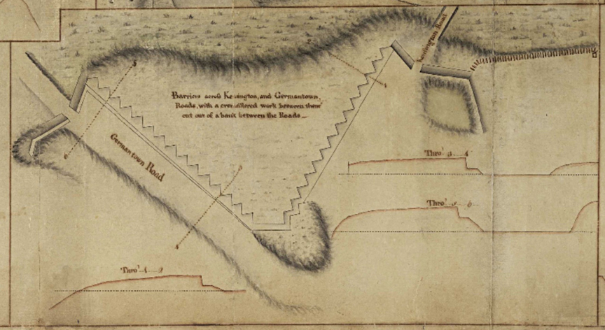
Straight history is presented in the sixth chapter, “Washington and the West.” Washington, due to his experience as a surveyor, was chosen to lead an expedition to the Ohio River Valley to get the French to leave. The young Virginian became a national figure, and consequently started the French and Indian War. After the war and before the Revolution, Washington continued to purchase and speculate in lands to the west. The seventh chapter explores some of the famous land surveys that were done during Washington’s time, including several pictures of the actual notes and maps made by surveyors. “The Surveyor in Chief” then provides a good deal of information about how Washington’s experience as a surveyor contributed to the growth of the United States. He helped to design the capital city that would one day bear his name, and he was responsible for the Rectangular Land Survey System, which was incorporated into the Northwest Ordinance of 1785.
Surveying America: The Point of Beginning, An Illustrated History, is a beautiful book. The pictures compliment the text perfectly, and that is good news for anyone who is not comfortable with math. Apart from some editorial shortcomings, the book is highly recommended for readers who are interested in mathematics, physics, or George Washington’s formative years.
PURCHASE THIS BOOK FROM AMAZON IN PAPERBACK
(As an Amazon Associate, JAR earns from qualifying purchases. This helps toward providing our content free of charge.)




2 Comments
This article says surveying tools have not changed, and that’s entirely false. There are now constellations of satellites orbiting the earth which enable GNSS or GPS surveys, there are unmanned aerial vehicles (drones) that can automate surveys, a modern total station (a surveying tool) can fit in a backpack but is packed with such precise and accurate instrumentation that it can cost more than a Tesla car. As a Civil Engineer I interact with surveyors frequently. It’s an amazing profession. Regardless of the many traditions and long history of surveying, the tools have changed drastically since George Washington completed his last survey.
I’m curious–does the book mention Samuel Holland or J.F.W. DesBarres?